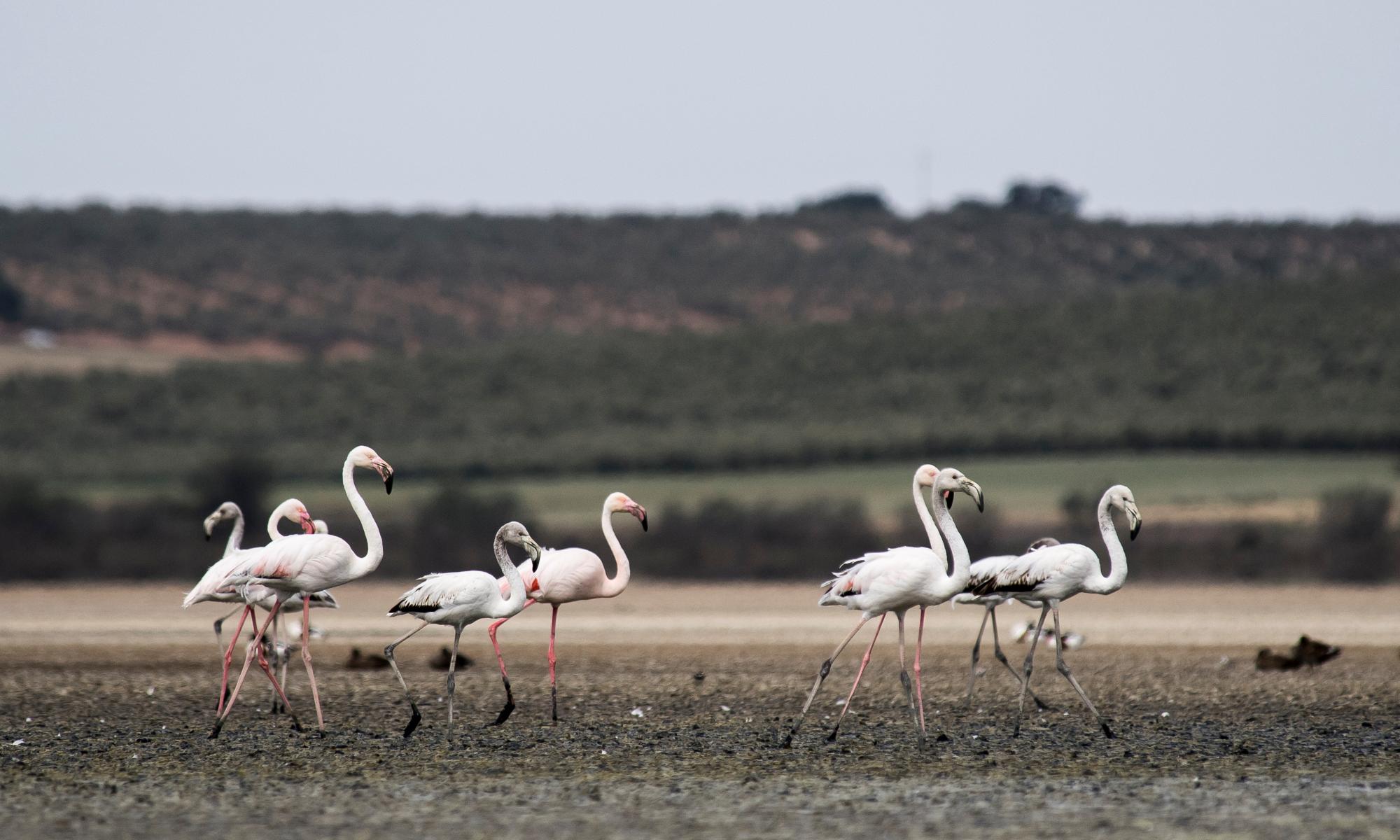
The ongoing wet weather across south-eastern Australia has shown no signs of abating, with flash and riverine flooding across large regions of New South Wales and Victoria.
In NSW there were 17 flood warnings – eight in the major flood category – across the state on Tuesday. Carlene York, the State Emergency Services commissioner, said the agency was leading “the biggest operations in relation to flood response across NSW in its history”. A natural disaster declaration, affecting 70 local government areas, had been in place since 14 September.
In the central west town of Forbes, residents were told to evacuate after the Lachlan River rose faster than forecast. It was the second major flood event the town had experienced in a fortnight, and the third in the last four weeks. The Bureau of Meteorology’s Steven Bernasconi said flood waters at Forbes were expected to reach 10.8 metres on Tuesday afternoon, similar to a flood in June 1952. Forbes saw the highest daily total rainfall in Australia in the last week, receiving 118mm in the 24 hours to 9am on Monday.
Those in affected areas can expect little reprieve, with more heavy rainfall predicted for the weekend. What is driving the continuing flood crisis?
Climate drivers
The last several months has seen three climate drivers in the Pacific, Indian and Southern Oceans all point towards a wet phase, says Dr Kimberley Reid, a research fellow at Monash University – specifically, La Niña, a negative Indian Ocean dipole, and a positive southern annular mode (Sam).
“La Niña elevates the risk of flooding because it contributes to increased background rainfall,” says Dr Agus Santoso, a senior research associate at the University of NSW’s climate change research centre. In addition to La Niña, “you can also have small-scale rainfall in localised rainfall events … generated by storms,” he says.
Reid says intense weather systems can develop in any season, and during an El Niño or a neutral year. “When they occur during a La Niña, because the ocean temperatures around Australia are a bit warmer, the atmosphere is primed for strong rainfall,” she says.
La Niña is expected to peak in November and decay as the summer months progress, says Santoso.
“We’re expecting it to be in neutral territory by February-March.” He adds that La Niña tends to coincide with the positive phase of the southern annual mode. “A positive Sam also means higher chance of increased rain over eastern Australia.”
As the wet climate drivers start to decay, there will hopefully be a slight reprieve, Reid says. “The negative Indian ocean dipole should start to return to normal in the next month or so.”
Saturated soils and variable rainfall
“It’s not taking much rain to cause flash flooding anywhere across our state,” the NSW premier, Dominic Perrottet, said on Tuesday.
“It’s only taking between 100mm and 150mm of rainfall overnight and we will have flash flooding and that can come up very, very quickly.”
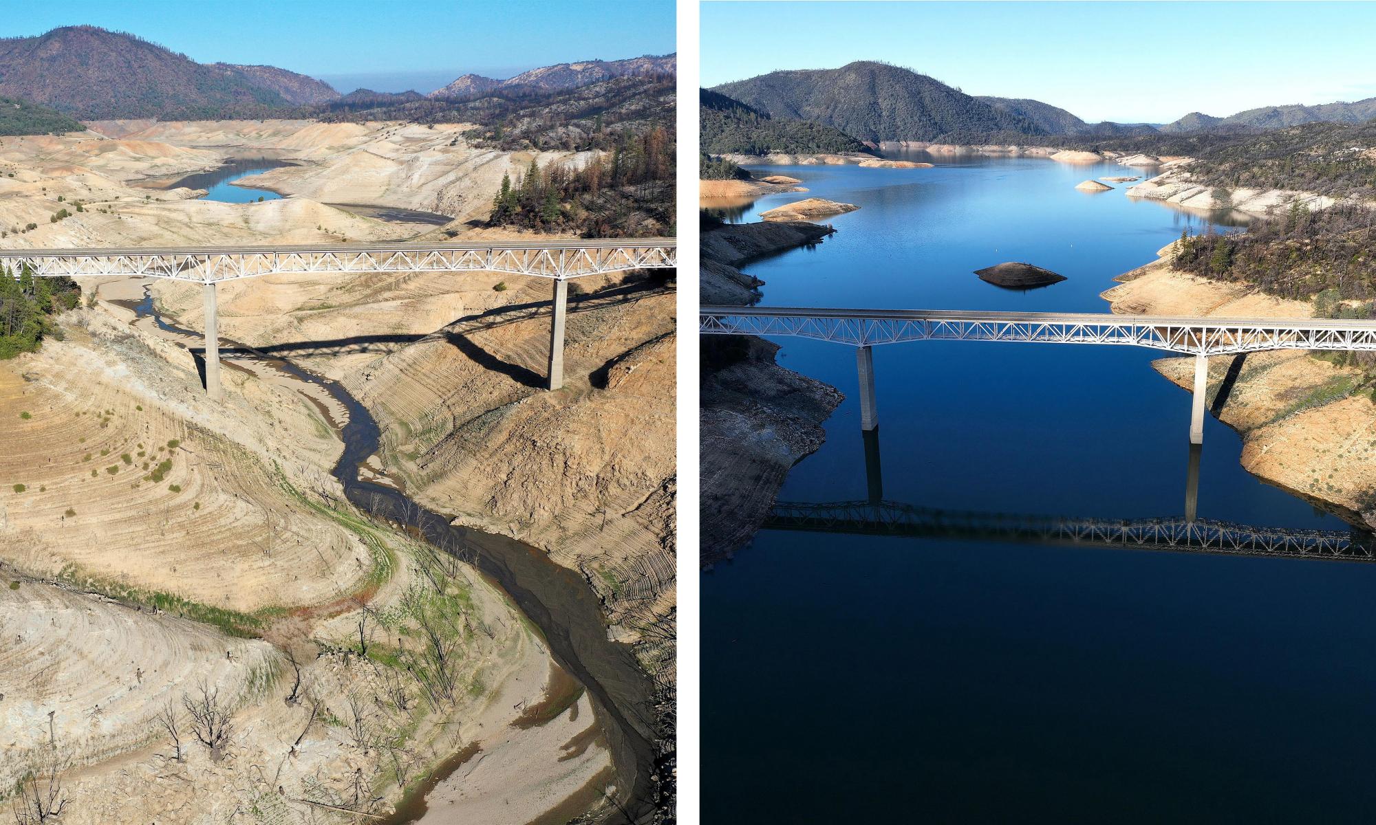
Full dams and already saturated soils from three consecutive years of La Niña events means that the landscape has very little ability to absorb more water.
“The first year of La Niña resulted in high rainfalls, but these were falling on dry soils,” says Prof Ashish Sharma, an engineering hydrologist also at UNSW.
“In the second year of La Niña, these higher rainfalls were falling on wetter soils … we have been seeing floods for the last two years fairly consistently as a result.”
How much rain needed to result in flash flooding varies by location, Sharma says. “It’s a function of the slope … and how the water congregates towards a river.”
US research has suggested that the highest rainfall of the year in a catchment typically has a 36% chance of leading to the catchment’s highest flood of the year. This risk drops to 13% if the rain is falling on dry soil, and jumps to 62% if falling on wet soil. “It’s indicative of the importance of the wetness of the soil,” Sharma says.
He adds that the differing impact in different regions is the result of spatial variability in rainfall. It is a matter of good and back luck, he says: “Who is lucky not to have extreme rainfall events fall upstream of them on wet soil.”
The Murray-Darling Basin experienced its wettest October on record, according to Ben Domensino, a meteorologist at Weatherzone. “The area-averaged total rainfall for the month was 138.46mm, smashing the previous October record of 101.96mm from 1950,” he wrote on Twitter.
Climate change
A heating planet means that under extreme scenarios the atmosphere can store a lot more moisture. “If there is more moisture in the sky and it comes down, it’ll create a bigger downpour,” Sharma says.
As an example, a study published last week found that rapid rain bursts over the greater Sydney region have intensified by at least 40% over the last two decades. The rate of intensification has been far greater than what was expected with climate change.
Rainfall is intensifying by 7% for each additional degree of global heating.
Sharma’s research predicts that the probable maximum precipitation across large dams in Australia will increase by between 14 to 38%. “This means that we are taking a bigger risk of dams failing now – and we will be taking bigger and bigger risks of the dams failing until the year 2100 – than was intended when the dams were built,” he says.