Flood maps used by the federal government are outdated, the director of the Federal Emergency Management Agency, or Fema, said on Sunday, considering a series of devastating floods caused by excessive rainfall induced by climate change.
Deanne Criswell told CNN’s State of the Union: “The part that’s really difficult right now is the fact that our flood maps don’t take into account excessive rain that comes in. And we are seeing these record rainfalls that are happening.”
Criswell was questioned about the situation in Jackson, Mississippi, where city water facilities failed in the aftermath of heavy flooding on the Pearl River, leaving residents without drinkable or usable water.
On Sunday, thunderstorms and heavy rain pounded parts of north-west Georgia, sparking flash floods. Local news reports showed roads under water and homeowners struggling.
The Georgia governor, Brian Kemp, declared a state of emergency in Chattooga and Floyd counties, directing all state resources to help with “preparation, response and recovery activities”.
The National Weather Service (NWS) reported rainfall of up to an inch an hour. Up to 12in was estimated to have fallen, according to Kemp’s executive order.
“This is an extremely dangerous and life-threatening situation,” the NWS said. “Do not attempt to travel unless you are fleeing an area subject to flooding or under an evacuation order.”
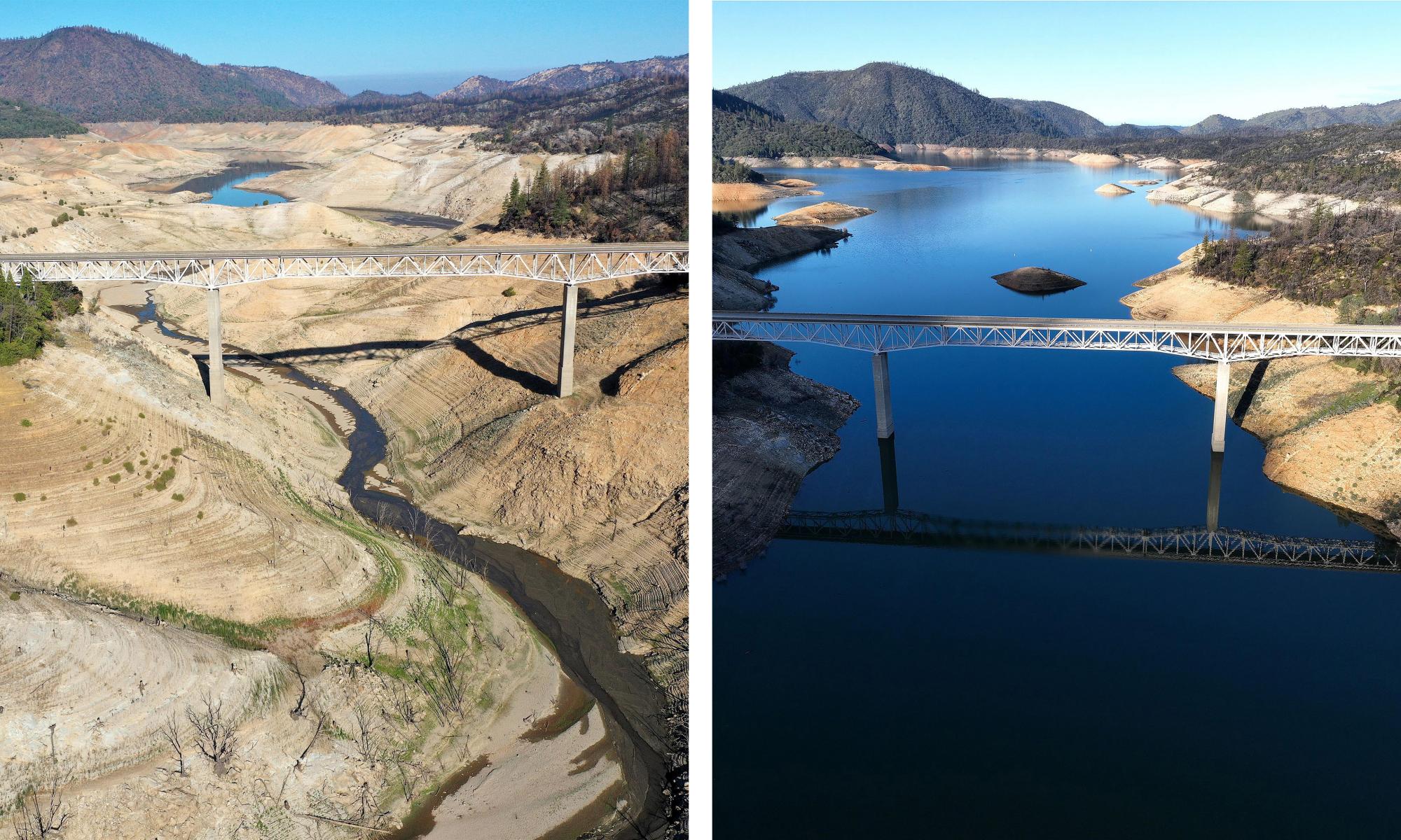
Such excessive rainfall and flooding will bring back into focus difficulties in predicting and responding to the climate crisis.
Criswell said Fema would work with local jurisdictions “to help them better identify what their needs are and help them create better predictive models, because we have to start thinking about what the threats are going to be in the future as a result of climate change, so they can put the mitigation measures in place”.
Last month, rainfall in Missouri, Kentucky and Illinois broke century-old records, causing devastation to communities, buildings and infrastructure.
“Fema’s maps right now are really focused on riverine flooding and coastal flooding and we work with local jurisdictions to update the maps,” Criswell said.
A 2020 study of flood risks by the nonprofit First Street Foundation that analyzed every property in the 48 contiguous US states found federal maps underestimated by 67% the number of homes and businesses in significant danger.
In Georgia on Sunday, the NWS declared a “flash flood emergency” for Summerville, Lyerly and James H Floyd State Park in Chattooga county. Floyd county, just to the south, was also under a flash flood warning. The NWS advised people to avoid non-emergency travel.
The city of Summerville advised residents who use the city’s water services to boil water prior to drinking, cooking or preparing baby food, due to flash flooding at the Raccoon Creek Filter plant.